How to reduce waste at school canteen? Post your comments here or propose a question.

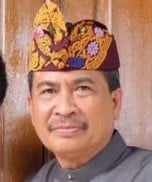
Ida Bagus Gede Wirawibawa

20220717T055819932Z094187.jpg
Full Name
Ida Bagus Gede Wirawibawa
Pen Name
Ida Bagus Gede Wirawibawa
Photograph by
private
Link to Photograph
https://udayananetworking.unud.ac.id/lecturer/3035-ida-bagus-gde-wirawibawa
Website for biography
Place
Denpasar
Related Music
Related Books
Related Scholars Articles


Add your comment
BASAbaliWiki welcomes all comments. If you do not want to be anonymous, register or log in. It is free.

Biography


In English

Lecturer in the Architecture Study Program of the Faculty of Engineering, Udayana University, born on May 2, 1961 in Denpasar, Bali. Elementary to high school education was completed in Jakarta (1968-1981). Bachelor of Engineering (S1) was completed in the Department of Architecture, Faculty of Engineering, Udayana University in 1988 and was appointed as a lecturer in the same department since 1991.

In 1995, he received a BPPS scholarship to continue his Master's degree and obtained a Masters in Architecture-Settlement in the Postgraduate Program, FTSP-ITS Surabaya in 1997. He completed his Cultural Studies S3 at the Udayana University Postgraduate Program and obtained his Doctorate degree in 2012. He once served as Assistant Dean III of the Faculty of Engineering, Udayana University, 2003-2007 period.

Aside from actively teaching in the Architecture Undergraduate Program, the Master of Architecture Program and the Doctoral Engineering Study Program at the Faculty of Engineering at Udayana University, he currently also serves as the Head of the Balinese Traditional Architecture Laboratory at the Architecture Study Program at the Faculty of Engineering, Udayana University.

In Balinese

In Indonesian

Examples of work

20220717T060205253Z307686.png
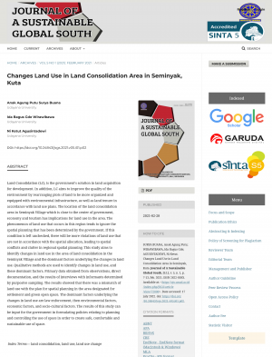
Land Consolidation (LC), is the government's solution in land acquisition for development. In addition, LC aims to improve the quality of the environment by rearranging plots of land to be more organized and equipped with environmental infrastructure, as well as land tenure in accordance with land use plans. The location of the land consolidation area in Seminyak Village which is close to the center of government, economy and tourism has implications for land use in the area. The phenomenon of land use that occurs in this region tends to ignore the spatial planning that has been determined by the government. If this condition is left unchecked, there will be more violations of land use that are not in accordance with the spatial allocation, leading to spatial conflicts and clutter in regional spatial planning. This study aims to identify changes in land use in the area of land consolidation in the Seminyak Village and the dominant factors underlying the changes in land use. Qualitative methods are used to identify changes in land use, and these dominant factors. Primary data obtained from observations, direct documentation, and the results of interviews with informants determined by purposive sampling. The results showed that there was a mismatch of land use with the plan for spatial planning in the area designated for settlement and green open space. The dominant factors underlying the changes in land use are law enforcement, then environmental factors, economicfactors, and socio-cultural factors. The results of this study can be input for the government in formulating policies relating to planning and controlling the use of space in order to create safe, comfortable and sustainable use of space.
Nothing was added yet.